Category:East Horsley
Jump to navigation
Jump to search
English: East Horsley is a village in Surrey, England, on the A246 between Leatherhead and Guildford. Neighbouring villages are West Horsley, Ockham, Effingham and Gomshall. Horsley railway station lies on the New Guildford Line between Guildford and London Waterloo. The census area Clandon and Horsley has a population of 8,409.
Nederlands: East Horsley is een plaats in het bestuurlijke gebied Guildford, in het Engelse graafschap Surrey. De plaats telt ca 8.000 inwoners.
village and civil parish in Surrey, England, UK  | |||||
| Upload media | |||||
| Instance of | |||||
|---|---|---|---|---|---|
| Location | Guildford, Surrey, South East England, England | ||||
| Area |
| ||||
| Said to be the same as | East Horsley (Wikimedia duplicated page, civil parish) | ||||
 | |||||
Subcategories
This category has the following 9 subcategories, out of 9 total.
D
- Duke of Wellington, East Horsley (19 F)
E
H
- Horsley Evangelical Church (8 F)
- Horsley railway station (31 F)
- Horsley Towers (10 F)
L
T
- The Forest and The Highlands (6 F)
Media in category "East Horsley"
The following 200 files are in this category, out of 263 total.
(previous page) (next page)-
 "Old London Road" - geograph.org.uk - 438417.jpg 480 × 640; 169 KB
-
 4x4 Byway - geograph.org.uk - 2998302.jpg 4,288 × 3,216; 3.63 MB
-
 Access road, East Horsley - geograph.org.uk - 4182073.jpg 2,001 × 1,510; 2.28 MB
-

-

-
 Anyone for tennis^ - geograph.org.uk - 4382908.jpg 800 × 533; 147 KB
-
 Arch Bridge,Horsley Station, Surrey - geograph.org.uk - 2766997.jpg 640 × 480; 130 KB
-
 Arch Railway Bridge - geograph.org.uk - 3784125.jpg 1,600 × 1,200; 661 KB
-
 Archway, Briary Hill, Dick Focks Common (2) - geograph.org.uk - 4054658.jpg 768 × 1,024; 280 KB
-
 Archway, Briary Hill, Dick Focks Common - geograph.org.uk - 4052543.jpg 784 × 1,024; 313 KB
-
 Arrow Slit - geograph.org.uk - 583328.jpg 480 × 640; 102 KB
-
 Autumn on Crocknorth Road - geograph.org.uk - 974794.jpg 640 × 480; 175 KB
-
 Berry Christmas - geograph.org.uk - 2727068.jpg 2,560 × 1,920; 1.78 MB
-
 Bishop's Gate - geograph.org.uk - 4382944.jpg 533 × 800; 149 KB
-
 Bishops gate, East Horsley - geograph.org.uk - 4182091.jpg 2,048 × 1,536; 2.76 MB
-
 Bishopsgate Lodge, East Horsley.jpg 5,184 × 3,456; 8.68 MB
-
 Bishopsmead Parade, East Horsley - geograph.org.uk - 2727055.jpg 2,560 × 1,920; 1.79 MB
-

-
 Bishopsmead, East Horsley - geograph.org.uk - 438373.jpg 640 × 480; 111 KB
-
 Bluebells, Greendene - geograph.org.uk - 2916320.jpg 2,520 × 1,680; 767 KB
-
 Board Meeting - geograph.org.uk - 2986713.jpg 4,288 × 3,216; 3.62 MB
-
 Bridge near Horsley Station, Surrey - geograph.org.uk - 2766991.jpg 1,024 × 768; 374 KB
-

-
 Bridleway going east in Ridings Wood - geograph.org.uk - 4382585.jpg 800 × 533; 214 KB
-
 Bridleway going west from path junction - geograph.org.uk - 4382589.jpg 800 × 533; 194 KB
-
 Bridleway near Hangers Wood - geograph.org.uk - 6023794.jpg 5,120 × 3,840; 6.18 MB
-

-
 Butcher's shop with consciously old-fashioned sign - geograph.org.uk - 3678596.jpg 4,320 × 3,240; 2.93 MB
-
 Car dealer, Guildford Road, East Horsley - geograph.org.uk - 2582772.jpg 4,320 × 3,240; 4.8 MB
-
 Car on a BOAT - geograph.org.uk - 2998308.jpg 4,288 × 3,216; 3.51 MB
-
 Car Park in the woods, Green Dene - geograph.org.uk - 3414591.jpg 2,048 × 1,536; 1.5 MB
-
 Car park off Green Dene - geograph.org.uk - 2654113.jpg 640 × 480; 161 KB
-
 Car salesroom, East Horsely - geograph.org.uk - 4182104.jpg 2,012 × 1,510; 1.91 MB
-
 Carlions Garage, East Horsley - geograph.org.uk - 565476.jpg 640 × 480; 133 KB
-
 Chimney with shields - geograph.org.uk - 4382930.jpg 533 × 800; 107 KB
-
 Closed Car Park in Mountain Wood - geograph.org.uk - 6025299.jpg 5,120 × 3,840; 6.74 MB
-
 Community Hall - geograph.org.uk - 4382682.jpg 800 × 533; 116 KB
-
 Corduroy Road by Dorking Arch - geograph.org.uk - 2986689.jpg 4,288 × 3,216; 3.53 MB
-
 Corner of Bishopsmead Close and Horsley Road - geograph.org.uk - 2710248.jpg 1,600 × 1,200; 617 KB
-
 Cornwallis Memorial - geograph.org.uk - 2061684.jpg 2,560 × 1,920; 2 MB
-
 Corsican Pine - geograph.org.uk - 2963794.jpg 3,216 × 4,288; 3.43 MB
-
 Cottage at Newmarsh - geograph.org.uk - 2286130.jpg 2,560 × 1,920; 1.79 MB
-
 Crocknorth House - geograph.org.uk - 2704075.jpg 640 × 480; 88 KB
-
 Culvert EH1-5, East Horsley - geograph.org.uk - 2704187.jpg 640 × 480; 169 KB
-
 Derelict building off The Drift, West Horsley - geograph.org.uk - 2729141.jpg 1,600 × 1,200; 599 KB
-
 Dorking Arch footbridge over Crocknorth Road - geograph.org.uk - 2774615.jpg 1,600 × 1,200; 543 KB
-
 Dorking Arch, Crocknorth Road - geograph.org.uk - 2998793.jpg 4,288 × 3,216; 2.97 MB
-
 Dorking Arch, Downhill Side - geograph.org.uk - 2986669.jpg 4,288 × 3,216; 3.47 MB
-
 Dorking Arch, Uphill Side - geograph.org.uk - 2986678.jpg 4,288 × 3,216; 3.75 MB
-
 Duke of Wellington - geograph.org.uk - 5263646.jpg 2,560 × 1,920; 3.27 MB
-
 Duncombe Farm House, East Horsley - geograph.org.uk - 3904497.jpg 1,280 × 851; 358 KB
-
 Duncombe House - geograph.org.uk - 3784137.jpg 1,600 × 1,200; 528 KB
-
 East Horsley - geograph.org.uk - 2726122.jpg 2,560 × 1,920; 1.58 MB
-
 East Horsley - geograph.org.uk - 2727076.jpg 1,920 × 2,560; 1.69 MB
-
 East Horsley - geograph.org.uk - 564267.jpg 640 × 480; 133 KB
-
 East Horsley - Old Manor House - geograph.org.uk - 4190078.jpg 1,000 × 619; 242 KB
-
 East Horsley Delivery Office - geograph.org.uk - 1936969.jpg 1,024 × 680; 232 KB
-
 East Horsley gatehouse - geograph.org.uk - 4182096.jpg 1,993 × 1,495; 2.46 MB
-
 East Horsley Milestone - geograph.org.uk - 438897.jpg 480 × 640; 121 KB
-
 East Horsley Telephone Exchange - geograph.org.uk - 2310913.jpg 3,072 × 2,304; 1.8 MB
-
 East Horsley village hall - geograph.org.uk - 2704194.jpg 640 × 480; 87 KB
-
 East Horsley, 1860 - geograph.org.uk - 2727052.jpg 2,560 × 1,920; 1.7 MB
-
 East Horsley, Barnsthorns Wood, the Blue Ride path.jpg 4,000 × 2,660; 4.92 MB
-
 East Horsley, churchyard and gazebo - geograph.org.uk - 5812534.jpg 814 × 1,024; 283 KB
-
 East Horsley, Forest Farm, Forest Road.jpg 4,000 × 2,660; 2.57 MB
-
 East Horsley, Pennymead Lake.jpg 3,500 × 2,327; 2.61 MB
-
 East Horsley, St Martin's parish church - geograph.org.uk - 5812888.jpg 1,024 × 838; 238 KB
-
 F. Conisbee, East Horsley - geograph.org.uk - 2727073.jpg 1,920 × 2,560; 1.9 MB
-
 Fearn Close - geograph.org.uk - 4382968.jpg 800 × 533; 155 KB
-
 Field entrance on Heath View, East Horsley - geograph.org.uk - 2245868.jpg 1,600 × 1,200; 523 KB
-
 Fields behind RamadaJarvis Hotel - geograph.org.uk - 1611969.jpg 640 × 480; 184 KB
-
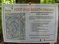 Foot and Mouth Disease Map - geograph.org.uk - 564718.jpg 640 × 480; 120 KB
-
 Forest Lane - geograph.org.uk - 4384128.jpg 800 × 533; 149 KB
-
 Forest Road, East Horsley - geograph.org.uk - 2389590.jpg 4,320 × 3,240; 4.68 MB
-
 Forest Road, East Horsley - geograph.org.uk - 2389599.jpg 4,320 × 3,240; 4.79 MB
-
 Forest Road, East Horsley - geograph.org.uk - 2710493.jpg 1,600 × 1,200; 375 KB
-
 Forest Road, East Horsley - geograph.org.uk - 2710848.jpg 1,600 × 1,200; 616 KB
-
 Forestry Commission, Oldlands - geograph.org.uk - 2704085.jpg 640 × 480; 192 KB
-
 Former Fortified Gate - geograph.org.uk - 3965691.jpg 1,600 × 1,200; 678 KB
-

-

-
 Gallows Grove - geograph.org.uk - 3904014.jpg 1,280 × 851; 574 KB
-
 Gate to field, Honeysuckle Bottom, Effingham - geograph.org.uk - 2213408.jpg 1,600 × 1,200; 608 KB
-
 Gateway, Ridings Wood - geograph.org.uk - 438409.jpg 640 × 480; 187 KB
-
 Gazebo on Ockham Road South - geograph.org.uk - 438875.jpg 480 × 640; 168 KB
-

-
 Green Dene - geograph.org.uk - 2710272.jpg 1,600 × 1,200; 567 KB
-
 Green Dene Plantation - geograph.org.uk - 2963772.jpg 4,288 × 3,216; 3.64 MB
-
 Green Dene though the North Downs - geograph.org.uk - 6025306.jpg 3,648 × 2,736; 6.09 MB
-
 Green Dene, East Horsley - geograph.org.uk - 4169283.jpg 2,510 × 1,827; 2.31 MB
-
 Green Dene, south of East Horsley - geograph.org.uk - 4440898.jpg 1,024 × 785; 280 KB
-
 Guildford Lodge Towers - geograph.org.uk - 2726131.jpg 1,920 × 2,560; 1.76 MB
-
 Guildford Road, East Horsley - geograph.org.uk - 2582779.jpg 4,320 × 3,240; 5.02 MB
-
 Half built house on The Drift, East Horsley - geograph.org.uk - 4285995.jpg 4,608 × 3,456; 4.94 MB
-
 Harebells - geograph.org.uk - 2986600.jpg 4,288 × 3,216; 4.07 MB
-
 Hermitage Arch - geograph.org.uk - 551046.jpg 640 × 480; 145 KB
-
 Hillside by Stony Dene - geograph.org.uk - 2986793.jpg 4,288 × 3,216; 3.65 MB
-
 Hockey Pitches at Horsley - geograph.org.uk - 1115889.jpg 640 × 480; 103 KB
-
 Horsley - geograph.org.uk - 2727100.jpg 2,560 × 1,920; 1.69 MB
-
 Horsley Court - geograph.org.uk - 2727048.jpg 2,560 × 1,920; 1.69 MB
-
 Horsley Football Club - geograph.org.uk - 1115876.jpg 640 × 480; 80 KB
-
 Horsley Jubilee Trail marker.jpg 1,000 × 1,008; 383 KB
-
 Horsley Railway Bridge - geograph.org.uk - 2727115.jpg 2,560 × 1,920; 1.68 MB
-
 Horsley railway station, Surrey - geograph.org.uk - 3775296.jpg 1,024 × 768; 253 KB
-
 Horsley Road - geograph.org.uk - 2286125.jpg 2,560 × 1,920; 1.75 MB
-
 Horsley Road at end of track from Newmarsh farm - geograph.org.uk - 2710228.jpg 1,600 × 1,200; 621 KB
-
 Horsley Towers gatehouse - geograph.org.uk - 4181382.jpg 2,048 × 1,536; 2.87 MB
-
 House on Forest Road, East Horsley - geograph.org.uk - 2710495.jpg 1,600 × 1,200; 329 KB
-
 House on the corner - geograph.org.uk - 2690423.jpg 640 × 428; 81 KB
-
 Houses on Forest Road, Effingham - geograph.org.uk - 2979101.jpg 800 × 600; 118 KB
-
 Houses on Green Dene, East Horsley - geograph.org.uk - 4169353.jpg 2,560 × 1,920; 1.57 MB
-
 Houses on Green Dene, East Horsley - geograph.org.uk - 4169355.jpg 2,560 × 1,920; 1.58 MB
-
 Howard Road, East Horsley - geograph.org.uk - 2389610.jpg 4,320 × 3,240; 4.71 MB
-
 HSBC Bank, East Horsley - geograph.org.uk - 2389578.jpg 4,320 × 3,240; 4.74 MB
-

-
 Innisfree bridge over footpath, Woodland Drive, East Horsley.jpg 2,660 × 4,000; 3.01 MB
-
 Junction of Green Dene and the A246 - geograph.org.uk - 2710258.jpg 1,600 × 1,200; 510 KB
-
 Junction of Lynx Hill and Pine Walk - geograph.org.uk - 4382916.jpg 800 × 533; 176 KB
-
 Junction of Parkside Close and Horsley Road - geograph.org.uk - 2710236.jpg 1,600 × 1,200; 505 KB
-
 La Meridiana - geograph.org.uk - 2727085.jpg 2,560 × 1,920; 1.68 MB
-
 Layby on Green Dene - geograph.org.uk - 2710273.jpg 1,600 × 1,200; 536 KB
-

-
 Looking along Woodland Close to house - geograph.org.uk - 4382905.jpg 533 × 800; 166 KB
-
 Looking east on Highfields - geograph.org.uk - 4382932.jpg 533 × 800; 163 KB
-
 Looking into Old Lane Gardens - geograph.org.uk - 4384065.jpg 800 × 533; 159 KB
-

-
 Looking past the bus stop on Epsom Road - geograph.org.uk - 4382960.jpg 800 × 533; 141 KB
-

-
 Looking westwards on Lynx Hill - geograph.org.uk - 4382913.jpg 800 × 533; 163 KB
-
 Lovelace Bridges Trail - geograph.org.uk - 2986659.jpg 3,216 × 4,288; 3.68 MB
-
 Lovelace Bridges Trail - geograph.org.uk - 2986702.jpg 4,288 × 3,216; 3.65 MB
-
 Lovelace Building, East Horsley - geograph.org.uk - 2727042.jpg 2,560 × 1,920; 1.77 MB
-
 Lovelace Coats-of-Arms - geograph.org.uk - 565486.jpg 480 × 640; 145 KB
-
 Lovelace Mausoleum - geograph.org.uk - 2061644.jpg 2,560 × 1,920; 2.23 MB
-
 Lovelace Mausoleum, East Horsley - geograph.org.uk - 2061668.jpg 2,560 × 1,920; 2.2 MB
-
 Meridiana Restaurant, East Horsley, Surrey - geograph.org.uk - 2049178.jpg 1,024 × 768; 288 KB
-
 Mock Tudor East Horsley - geograph.org.uk - 2727080.jpg 2,560 × 1,920; 1.71 MB
-
 Modern house on Norrels Drive, East Horsley - geograph.org.uk - 2245890.jpg 1,600 × 1,200; 590 KB
-
 Mountain Wood, Sheepleas - geograph.org.uk - 3414592.jpg 2,048 × 1,536; 1.63 MB
-
 New Development at Effingham Junction - geograph.org.uk - 2286080.jpg 2,560 × 1,920; 1.94 MB
-
 Nomad Theatre - geograph.org.uk - 2727060.jpg 2,560 × 1,920; 1.71 MB
-
 Nomad Theatre, East Horsley.jpg 5,184 × 3,456; 8.47 MB
-

-
 Ockham Road North, West Horsley - geograph.org.uk - 2221497.jpg 1,600 × 1,200; 537 KB
-
 Ockham Road South - geograph.org.uk - 2727077.jpg 2,560 × 1,920; 1.6 MB
-
 Ockham Road South - geograph.org.uk - 6025150.jpg 5,120 × 3,840; 7.83 MB
-
-
 Ockham Road South, East Horsley - geograph.org.uk - 2387211.jpg 4,320 × 3,240; 4.74 MB
-
 Ockham Road South, East Horsley, Surrey - geograph.org.uk - 2049192.jpg 1,024 × 768; 258 KB
-
 Ockham Road South, East Horsley, Surrey - geograph.org.uk - 2049194.jpg 1,024 × 768; 424 KB
-
 Ockham Road South, East Horsley, Surrey - geograph.org.uk - 2049201.jpg 1,024 × 768; 259 KB
-
 Old Lane - geograph.org.uk - 2286117.jpg 2,560 × 1,920; 1.69 MB
-
 Old Lane, Effingham Junction, Surrey - geograph.org.uk - 3349389.jpg 4,000 × 2,662; 7.21 MB
-
 Old Manor House - geograph.org.uk - 438350.jpg 640 × 480; 127 KB
-
 Old Well, East Horsley - geograph.org.uk - 438892.jpg 480 × 640; 150 KB
-
 On Tow - geograph.org.uk - 4311523.jpg 1,798 × 1,199; 458 KB
-
 One way onto Effingham Common - geograph.org.uk - 4382683.jpg 800 × 526; 149 KB
-
 Parade of shops - geograph.org.uk - 4382939.jpg 800 × 533; 111 KB
-
 Parade of shops, Ockham Road South, East Horsley - geograph.org.uk - 2389575.jpg 4,320 × 3,240; 4.72 MB
-
 Park Corner - geograph.org.uk - 2727071.jpg 2,560 × 1,920; 1.66 MB
-
 Park Corner, East Horsley - geograph.org.uk - 3632213.jpg 773 × 1,024; 170 KB
-
 Parkside Close, East Horsley - geograph.org.uk - 2389583.jpg 4,320 × 3,240; 4.46 MB
-
 Pepperpot Tower, East Horsley - geograph.org.uk - 2061735.jpg 2,560 × 1,920; 2.37 MB
-
 Pillars of the Community - geograph.org.uk - 2727030.jpg 2,560 × 1,920; 1.66 MB
-
 Pleased to Meet You, Deer - geograph.org.uk - 2986622.jpg 1,805 × 1,495; 883 KB
-
 Public footpath, Honeysuckle Bottom - geograph.org.uk - 2290253.jpg 1,600 × 1,200; 560 KB
-
 Railway line by The Forest - geograph.org.uk - 4384122.jpg 800 × 533; 127 KB
-
 Ramada Jarvis Hotel, East Horsley - geograph.org.uk - 438827.jpg 640 × 480; 146 KB
-
 RamadaJarvis Hotel and its car park - geograph.org.uk - 1611970.jpg 640 × 480; 241 KB
-
 Raven Arch - geograph.org.uk - 2986643.jpg 3,216 × 4,288; 3.59 MB
-
 Raven Arch, Coles Copse - geograph.org.uk - 2986652.jpg 4,288 × 3,216; 3.51 MB
-
 Red phone box at Horsley station - geograph.org.uk - 4766772.jpg 1,600 × 1,200; 432 KB
-
 Rhododendron walk in Mountain Wood, East Horsley.jpg 3,000 × 2,250; 3.71 MB
-
 Road junction in Effingham Common - geograph.org.uk - 2710232.jpg 1,600 × 1,200; 523 KB
-
 Robin Hood Bridge - geograph.org.uk - 2998812.jpg 3,216 × 4,288; 3.75 MB
-
 Sharp Bend on the A246 near East Horsley - geograph.org.uk - 6025133.jpg 5,120 × 3,840; 7.91 MB
-

-
 Shopping parade, East Horsley - geograph.org.uk - 1579079.jpg 640 × 480; 71 KB
-
 Shopping parade, Ockham Road South, East Horsley - geograph.org.uk - 2389571.jpg 4,320 × 3,240; 3.9 MB
-
 Shops close to East Horsley Station, Surrey - geograph.org.uk - 2049187.jpg 1,024 × 768; 320 KB
-
 Sign for Dick Focks Common - geograph.org.uk - 4825373.jpg 2,048 × 1,536; 1.43 MB
-
 Sign for Old Lane Gardens, Effingham - geograph.org.uk - 2702019.jpg 1,600 × 1,200; 573 KB
-
 SIHG Plaque - geograph.org.uk - 2986734.jpg 4,288 × 3,216; 3.51 MB
-
 Stocks and table - geograph.org.uk - 4382956.jpg 800 × 732; 208 KB
-
 Stony Dene - geograph.org.uk - 2986760.jpg 4,288 × 3,216; 3.47 MB
-
 The Drift at the corner of Forest Road - geograph.org.uk - 5362337.jpg 2,190 × 1,564; 1.79 MB
-
 The Drift, East Horsley - geograph.org.uk - 2728875.jpg 1,600 × 1,200; 537 KB
-
 The Drift, East Horsley - geograph.org.uk - 2728879.jpg 1,600 × 1,200; 616 KB
-
 The Drift, East Horsley - geograph.org.uk - 2728883.jpg 1,200 × 1,600; 531 KB
-
 The Drift, East Horsley - geograph.org.uk - 4213621.jpg 2,304 × 1,728; 755 KB
-
 The Drift, East Horsley - geograph.org.uk - 4286537.jpg 4,608 × 3,456; 4.09 MB
-
 The entrance to Dick Focks Common - geograph.org.uk - 4825369.jpg 2,048 × 1,536; 1.25 MB
-
 The entrance to Drift Bridge Golf Club - geograph.org.uk - 4211194.jpg 2,304 × 1,728; 813 KB
-
 The Epsom Road, East Horsley - geograph.org.uk - 4182052.jpg 1,955 × 1,466; 2.22 MB
-

-
 The Forest - geograph.org.uk - 3904183.jpg 1,280 × 851; 510 KB
-
 The gazebo, east Horsley - geograph.org.uk - 4182068.jpg 2,048 × 1,536; 3.23 MB
-
 The Highlands - geograph.org.uk - 6025386.jpg 3,648 × 2,736; 4.99 MB
-
 The New Line, Effingham Junction - geograph.org.uk - 564735.jpg 640 × 480; 133 KB
-
 The Nomad Theatre - geograph.org.uk - 4384982.jpg 4,320 × 3,240; 2.51 MB


_-_geograph.org.uk_-_5813034.jpg)
_-_geograph.org.uk_-_5813040.jpg)


_-_geograph.org.uk_-_4054658.jpg)


